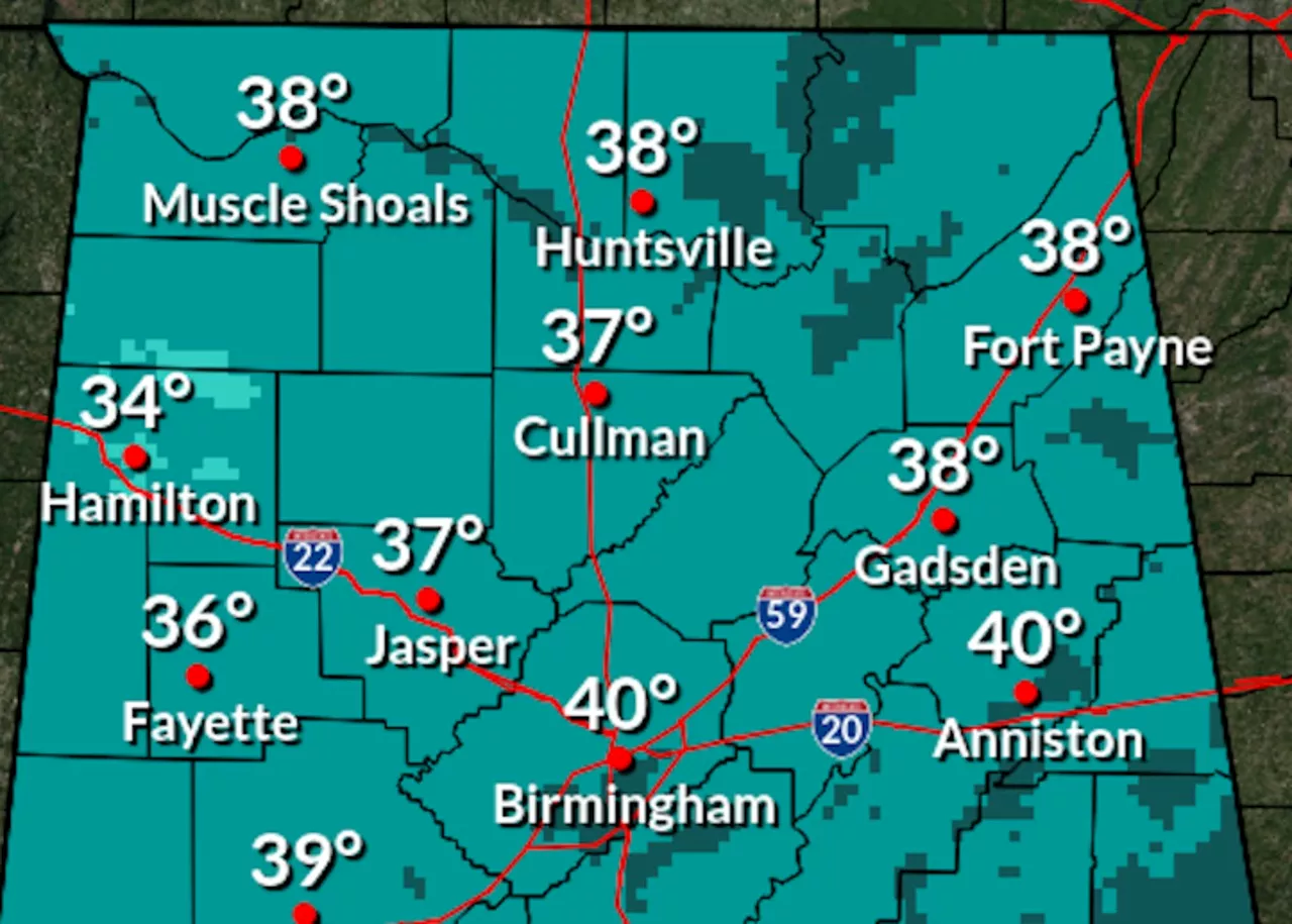
UPDATE: Alabama is bracing for a chilly start to the work week, with temperatures plunging into the 30s and 40s tonight. The National Weather Service has confirmed that a new wave of cold air will sweep across the state, bringing potential frost to many areas.
As rain showers are anticipated today, particularly in northeastern Alabama, the weather will remain cool statewide, with highs barely reaching the 50s. Residents should prepare for a significant drop in temperatures tonight, as lows in northern Alabama could dip to the mid-30s, while southern regions may see temperatures in the low to mid-40s.
“Frost is possible in north and central Alabama, and even parts of south Alabama could experience patchy frost,” the National Weather Service advised.
But there’s good news on the horizon! Following this cold snap, a warm-up is set to begin on Monday, with temperatures expected to rebound into the 60s and 70s by mid-week. By Friday and Saturday, parts of southern Alabama could even soar into the 80s, as the state enjoys a reprieve from winter’s chill.
The latest forecasts indicate that after Monday, the likelihood of rain will decrease significantly, with low chances re-emerging only on Friday for northern Alabama. This marks a welcome change for many who are eager for milder temperatures.
According to the Climate Prediction Center, Alabama is projected to experience above-average temperatures from November 9-15, with probabilities reaching as high as 50-60% in parts of western Alabama. This shift will bring much-needed warmth after the cold front passes.
As residents navigate this unpredictable weather, staying informed is crucial. Be sure to prepare for a chilly start to the week, but keep an eye on the forecast for a much warmer weekend ahead!