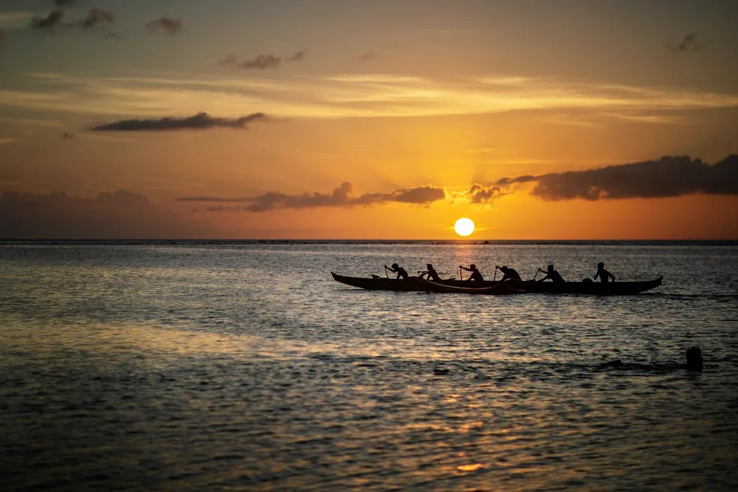
In an era dominated by modern navigation technologies, Pacific voyagers have been successfully navigating vast ocean distances using traditional techniques that date back centuries. This remarkable knowledge, rooted in the cultural practices of Pacific Islanders, demonstrates their ability to traverse the seas without relying on contemporary instruments.
In May 1972, anthropologist Richard (Rick) Feinberg embarked on a research expedition to the remote island of Anuta, located in the eastern Solomon Islands. Measuring just half a mile in diameter and situated 75 miles (120 kilometers) from its closest inhabited neighbor, Anuta remains one of the few places where inter-island travel via outrigger canoes is still a common practice. During his stay, Feinberg participated in a bird-hunting expedition to the uninhabited island of Patutaka, covering 20 hours of travel time over a two-day period. This experience laid the groundwork for decades of research exploring the navigation techniques employed by Pacific Islanders.
Navigators across the Pacific utilize various methods, often tailored to specific geographical and environmental conditions. Central to their expertise is the mental mapping of islands and the relationship of potential destinations to celestial bodies, ocean currents, winds, and waves. The fascination with Pacific voyaging has been rekindled in recent years, particularly through popular media like Disney’s “Moana.” Yet, European admiration for these navigators stretches back to the 18th century.
In 1768, French explorer Louis Antoine de Bougainville referred to Samoa as the “Navigators’ Islands.” British captain James Cook marveled at the speed and agility of Indigenous canoes, even welcoming Tupaia, a navigational expert, aboard his ship to document his extensive geographic knowledge.
The exploration of Pacific navigation continued with significant contributions from scholars and adventurers. In 1938, Te Rangi Hīroa (also known as Sir Peter Buck) published “Vikings of the Sunrise,” detailing Pacific exploration as depicted in Polynesian legends. In 1947, Norwegian explorer Thor Heyerdahl famously sailed from Peru to the Tuamotu Islands on the balsa wood raft named Kon-Tiki, igniting further interest in ancient navigation practices.
Despite skepticism from some historians, who argued that long-distance navigation without instruments was impossible, subsequent research proved otherwise. In 1970, Thomas Gladwin published “East Is a Big Bird,” studying the navigation practices of the Micronesian island of Polowat. Two years later, David Lewis released “We, the Navigators,” documenting the wayfinding techniques used across Oceania.
The Polynesian Voyaging Society has played a pivotal role in reviving these ancient practices. They constructed the double-hull voyaging canoe Hōkūle‘a, adhering to traditional designs while employing modern materials. In 1976, under the guidance of Micronesian navigator Mau Piailug, Hōkūle‘a completed a remarkable journey of over 2,500 miles from Hawai‘i to Tahiti without any navigational instruments. This achievement culminated in a global circumnavigation in 2017.
The primary method of navigation for many Pacific voyagers is celestial navigation, which relies on the positioning of stars. Navigators align their vessels with stars that rise or set directly over their intended destinations. However, this technique requires a profound understanding of astronomy, as the visibility of stars and their rising and setting points vary throughout the year.
Navigators must also account for factors such as leeway, which is the sideways drift caused by winds and currents. They adjust the alignment of their vessels based on their knowledge of these forces. During the day, the Sun serves a similar purpose, helping sailors determine their course when stars are not visible.
Moreover, Pacific navigators utilize a range of environmental indicators. Swells, for instance, are waves generated by distant winds that maintain their direction, providing navigators with essential information about their heading even in the dark. In some regions, multiple swell patterns exist, and skilled voyagers can discern them based on size, strength, and direction.
As navigators approach their target islands, they rely on additional cues to pinpoint their locations. Reflected waves, which bounce off islands and return to sea, serve as a critical indicator. Birds and changes in the sky’s color can also signal proximity to land, with certain species returning to their nests at specific times of day.
Estimating one’s position at sea involves complex calculations. Navigators track their starting point, speed, and direction to determine their longitude through a method known as dead reckoning. Some Micronesian navigators utilize a system called etak, which visualizes the relationship between their canoe and a reference island.
For thousands of years, Pacific voyagers have successfully crossed the vast Pacific Ocean using these sophisticated techniques, all passed down through generations. Their navigation practices highlight the depth of knowledge and cultural heritage that defines the Pacific Islands.
This article draws on research and insights from Richard (Rick) Feinberg at Kent State University, who has explored these traditional navigation techniques and their significance in contemporary contexts. His work emphasizes the enduring legacy of Pacific navigators and their ability to traverse the world’s largest ocean without modern instruments.