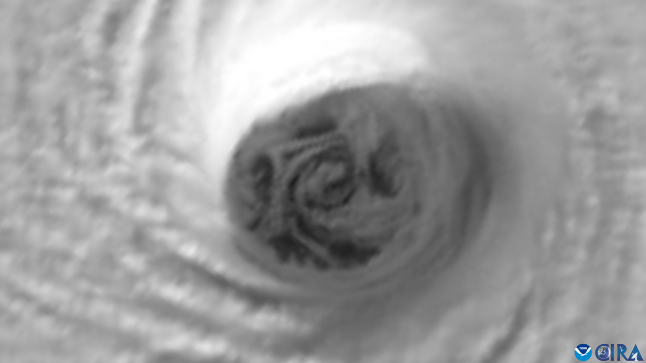
Satellite imagery reveals the devastating impact of Hurricane Melissa as it rotates through the Caribbean. The storm, classified as a Category 5 hurricane, reached peak winds of 185 miles per hour (295 kilometers per hour) when it struck Jamaica on October 28, 2023. According to the National Oceanic and Atmospheric Administration (NOAA), images from the GOES-19 satellite show distinctive “mesovortices” forming around the eye of the hurricane, indicating extreme weather conditions.
Mesovortices are small-scale rotational features that appear under specific atmospheric conditions characterized by significant differences in wind speed and direction. These phenomena highlight the complex dynamics within the storm, which has been described by weather experts as one of the most powerful hurricanes ever recorded in the Atlantic Ocean.
As the storm ripped through Jamaica, emergency authorities confirmed at least four fatalities, primarily in the southwest region of the island. Desmond McKenzie, deputy chair of Jamaica’s disaster risk management council, stated that the situation remains dire, with approximately 72% of the island without power and 65% of mobile phone sites down. The impact on infrastructure has been severe, leaving many communities in distress.
In neighboring Haiti, the storm’s aftermath has been equally tragic. Reports indicate that at least 25 people have died, with an additional 18 individuals reported missing due to extensive flooding. The region has faced significant challenges in emergency response and recovery efforts.
Cuba also felt the effects of Hurricane Melissa, although no fatalities were reported after it made landfall as a Category 3 storm on October 29, 2023. Many areas remain without access to electricity, internet, and telephone services due to downed transformers and power lines, further complicating recovery efforts.
As of October 30, 2023, Hurricane Melissa has downgraded to a Category 2 storm, with sustained winds nearing 105 mph (169 kph). The storm is currently located approximately 515 miles (830 kilometers) southwest of Bermuda, which remains under a hurricane warning as authorities continue to monitor its trajectory.
The intensity of Hurricane Melissa raises concerns regarding the increasing severity of hurricanes, a trend attributed in part to human-driven climate change. Experts indicate that such phenomena may become more common as global weather patterns evolve.
As recovery efforts begin, the focus remains on providing aid to those affected and restoring essential services across the impacted regions. The ongoing situation underscores the urgent need for climate action to mitigate the effects of extreme weather events in the future.


