Strong Storms to Hit Tonight with Large Hail Risk Across Southern Areas
Strong thunderstorms will sweep through tonight primarily along and south of Interstate 20, bringing a marginal threat of large hail and damaging winds, according to the CBS 42 Weather Livestream Channel. This latest round of severe weather is driven by a cold front slowly drifting south, combined with an upper-level disturbance moving west to east along the front.
The storm risk, though not widespread, carries a Marginal Risk level 1 out of 5 for severe weather, emphasizing that residents along southern corridors should stay alert to rapidly changing conditions. Forecasters warn that accumulated rainfall could reach 2 to 3 inches by daybreak, a development expected to ease drought conditions that have gripped the region.
Thursday Brings Brief Dry and Cool Conditions Before More Rain Friday
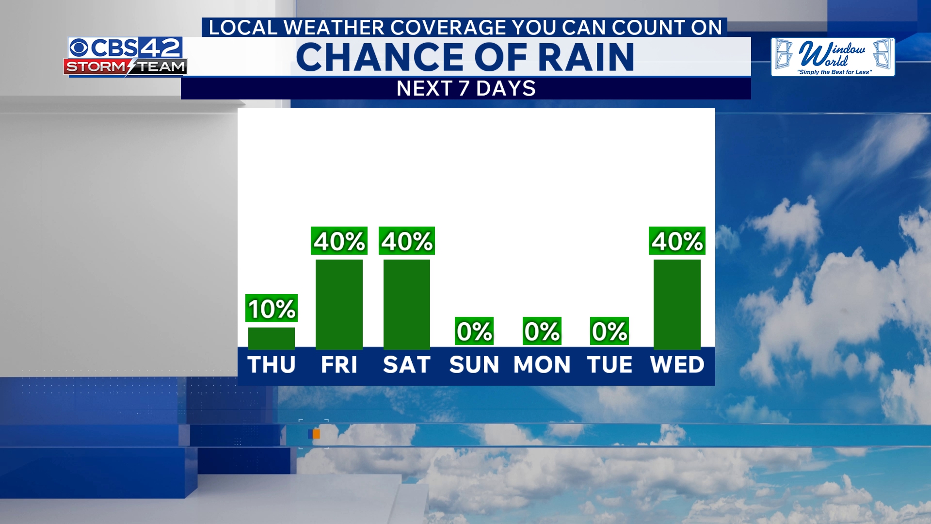
After the rain tapers off Thursday morning as the front shifts toward the Gulf Coast, residents will see a partly cloudy sky and cooler temperatures with highs in the mid-70s. Though Thursday offers a breather from wet weather, the calm is short-lived.
A new weather system arrives Friday as an area of low pressure moves west to east along a stalled coastal boundary, triggering scattered showers and non-severe thunderstorms. Expect cooler highs to drop into the upper 60s, signaling a clear change in the pattern heading toward the weekend.
More Showers and Storms Expected Friday Night into Saturday Morning
Friday night will bring plenty of rain and storms that may linger into Saturday morning before conditions gradually clear out. Overnight lows will dip into the upper 40s to around 50 degrees, followed by a cool Saturday afternoon with highs remaining in the upper 60s.
Saturday night will be mostly clear and colder, with lows dipping into the 40s. Sunday’s outlook is brighter with plenty of sunshine and highs again in the upper 60s, offering welcome relief after days of unsettled weather.
What Montanans and US Readers Need to Know Now
While this storm system is focused mainly along southern routes such as I-20, it exemplifies a broader shift toward cooler, wetter weather moving across parts of the southern US this week. For residents, the immediate priorities are safety and preparedness as storms with large hail could lead to property damage and dangerous driving conditions.
The significant rainfall already accumulating will help mitigate drought stress in affected areas, but heavy rain also raises the potential for flash flooding in vulnerable spots. Keeping updated through reliable sources like CBS 42 Weather Livestream is essential for those in the storm’s path.
Experts advise the public to monitor changing conditions tonight and into Friday, especially if traveling along southern corridors where storms will be strongest. The cooler, stormy pattern may impact agriculture and outdoor activities, underscoring the importance of timely weather awareness.
Stay Alert as Weather Develops Tonight and Into the Weekend
Montana and US readers should watch for updates as the cold front slowly migrates southward and interacts with other atmospheric disturbances, producing the waves of rain and storms. While Montana is not in the immediate threat zone, the weather pattern reflects a dynamic period of variability impacting large parts of the country.
Key takeaway: Expect strong storms with large hail tonight, brief dry conditions Thursday, then more wet and cooler weather Friday through the weekend. Stay tuned to trusted weather sources and take necessary precautions tonight.
CBS 42 Weather Livestream Channel: “A marginal severe risk exists this evening for large hail and damaging winds mainly along and south of I-20.”
For continuous updates and alerts on this developing weather threat, keep Montana Insider bookmarked and follow local broadcasters for breaking weather news.